Studio : Design VI in Rome and Monograph
Instructors : John Zissovici, Alberto Iacovoni, and Andrea Simitch
Spring 2019 and Spring 2020
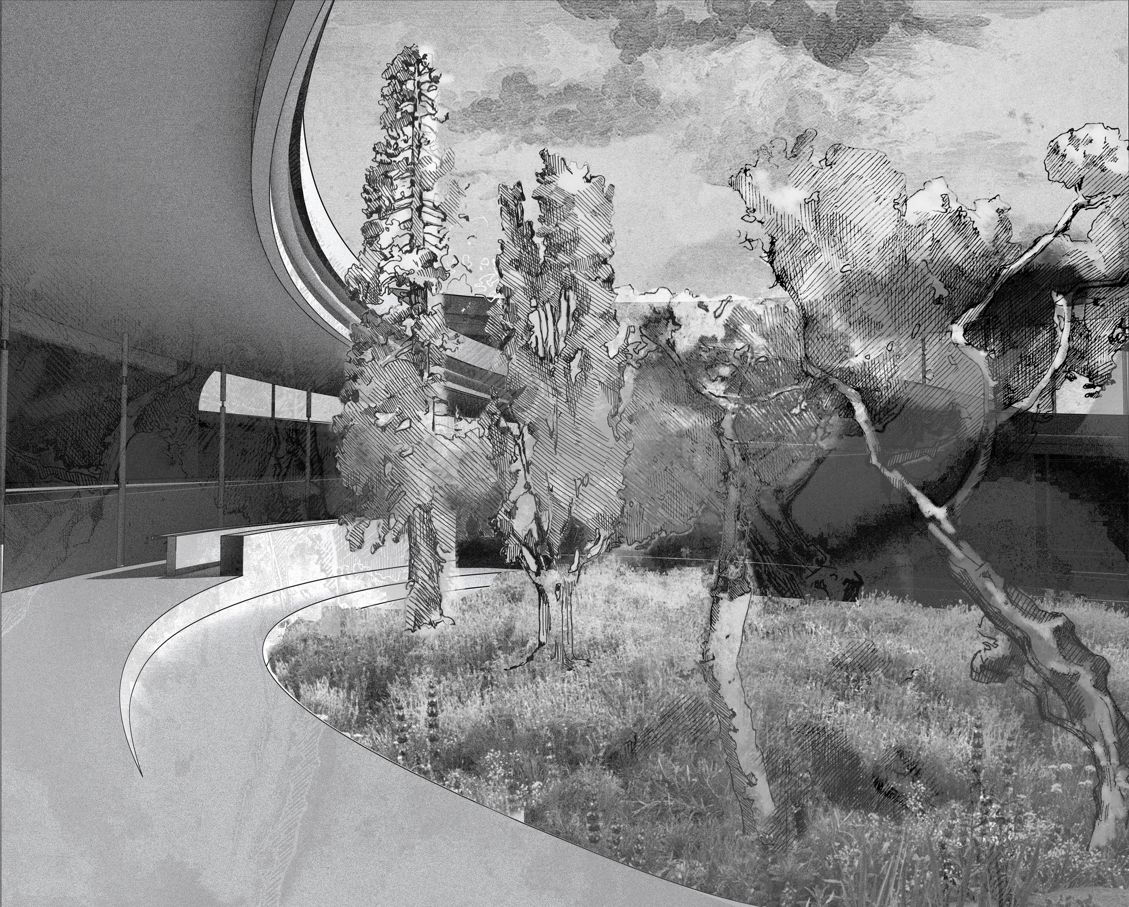
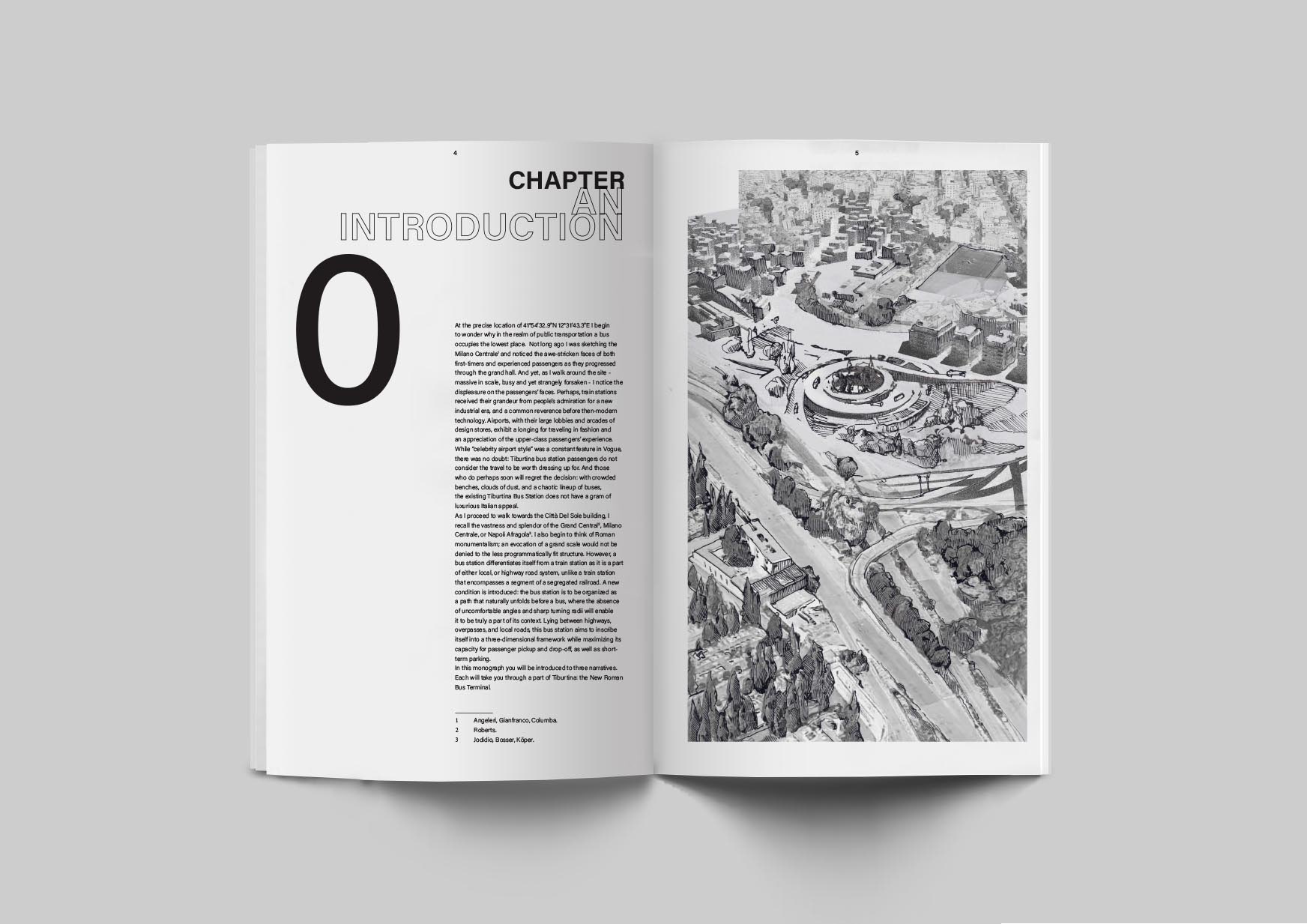
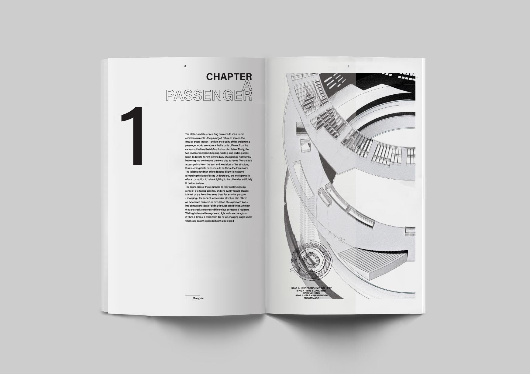
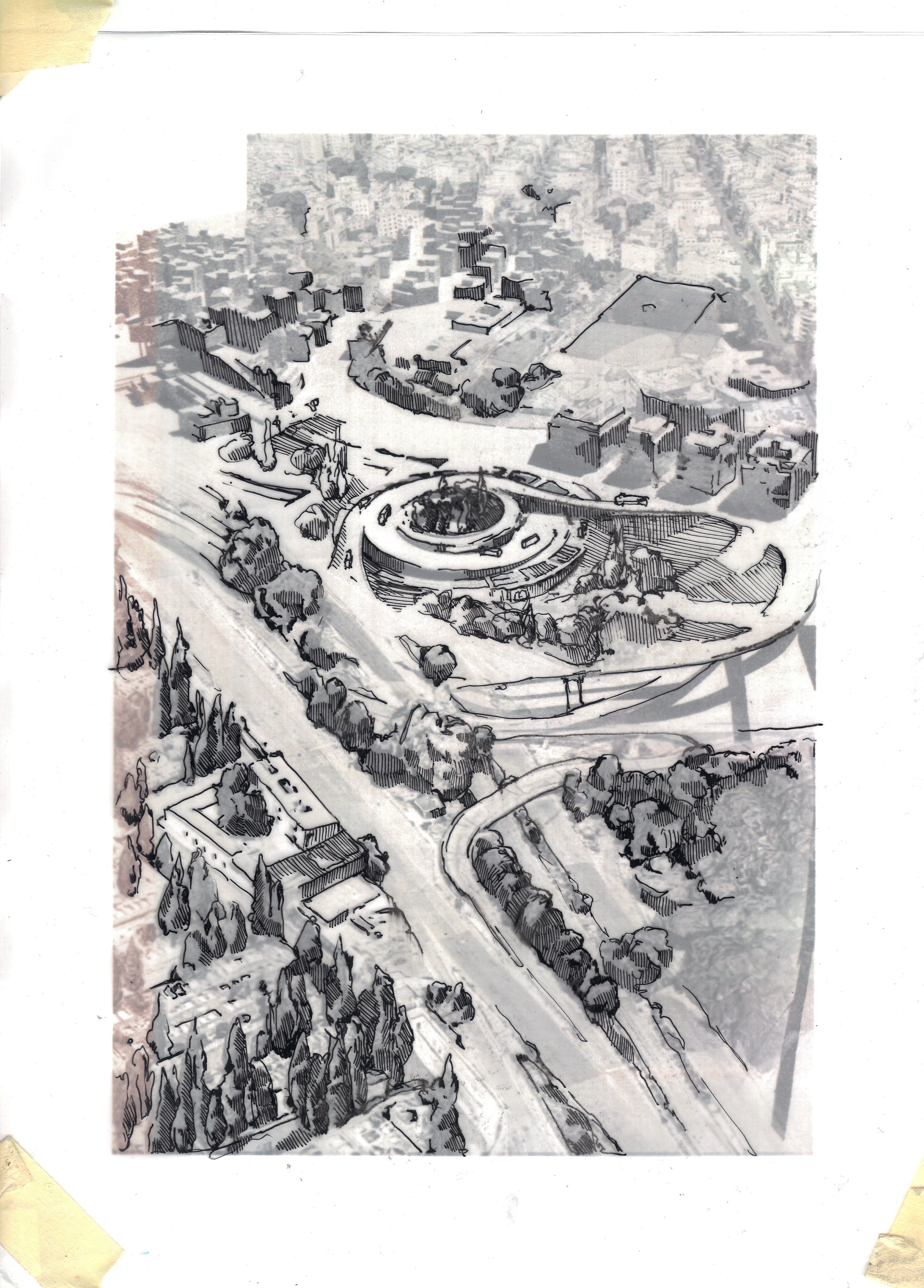
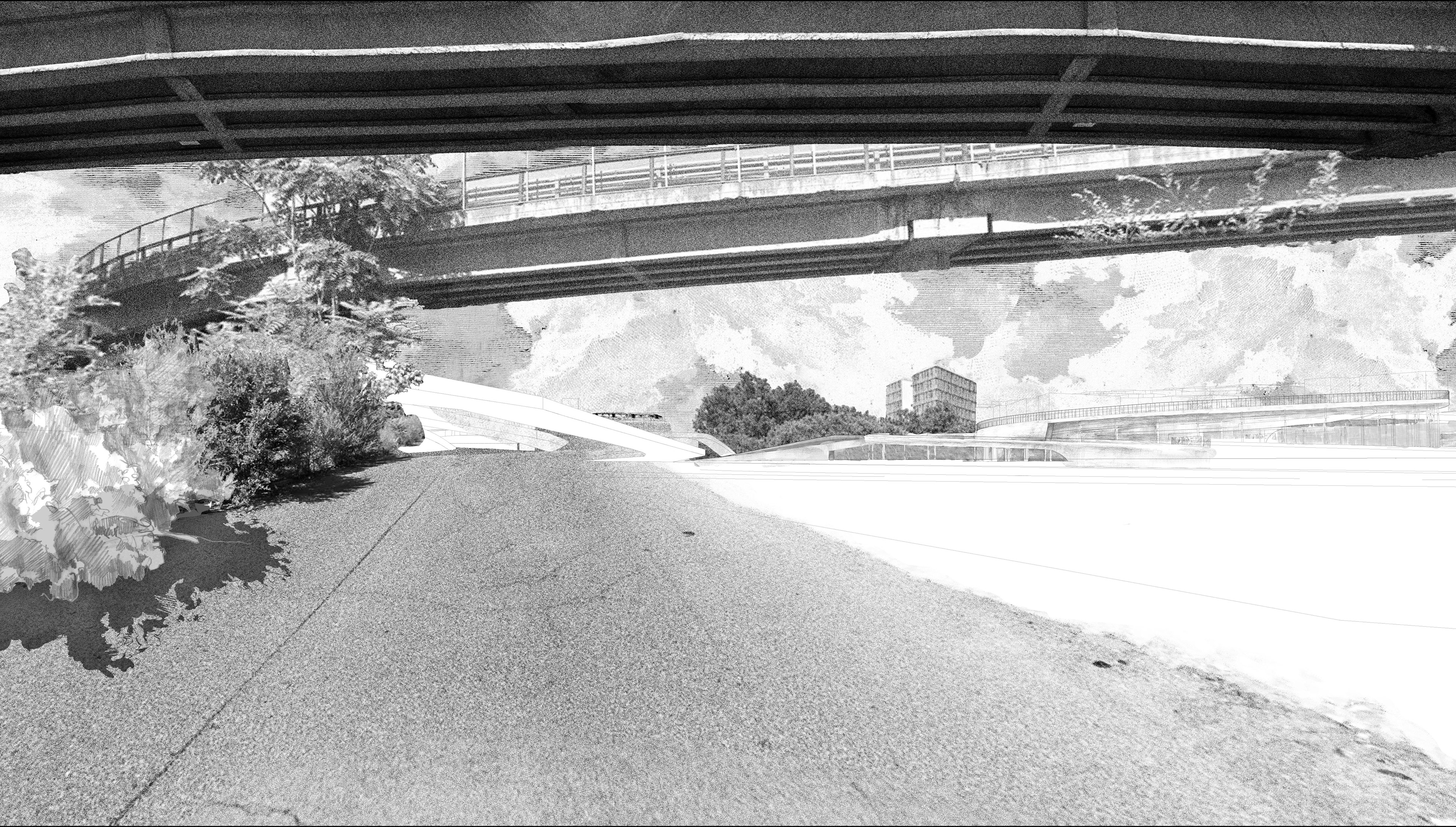
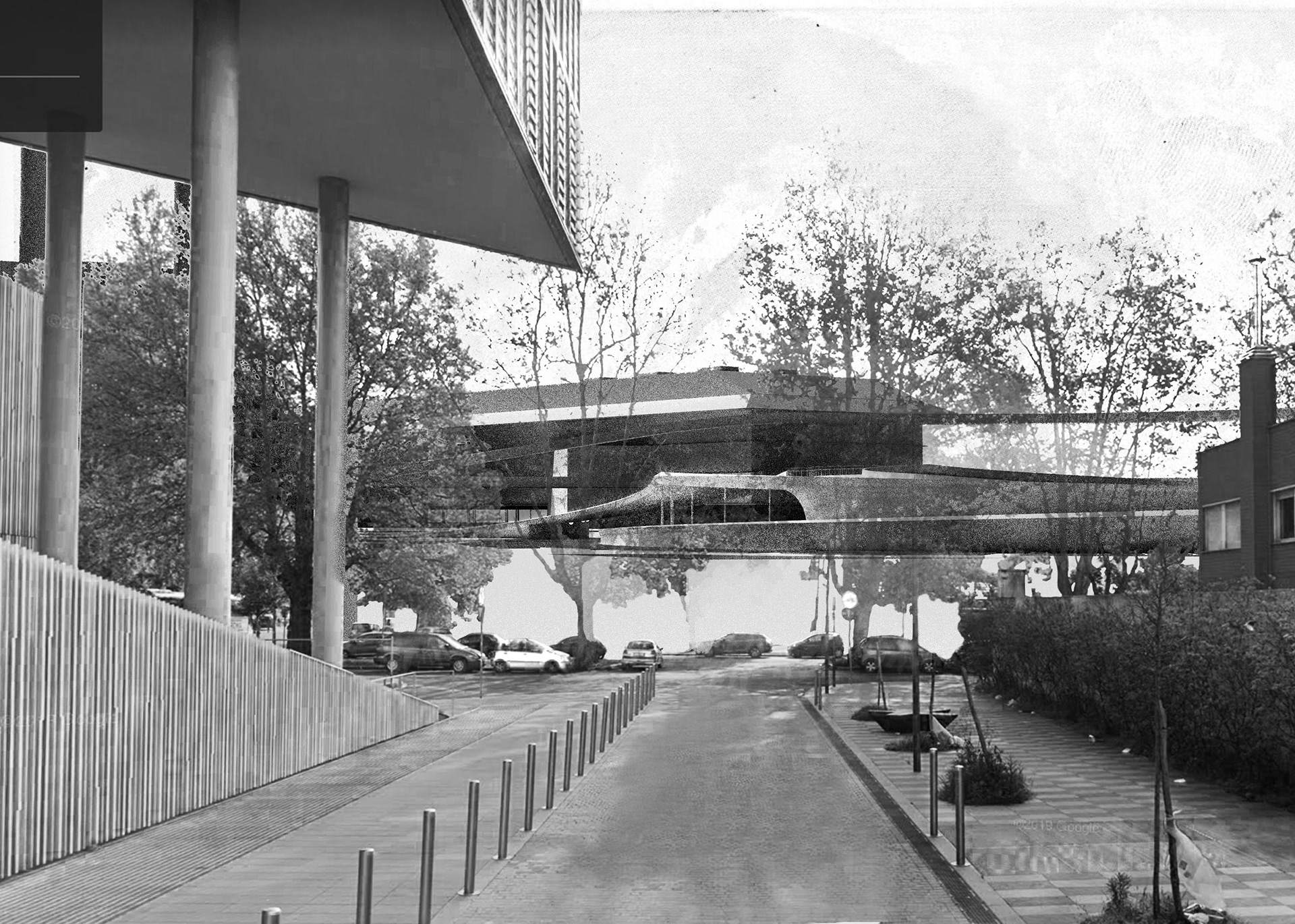
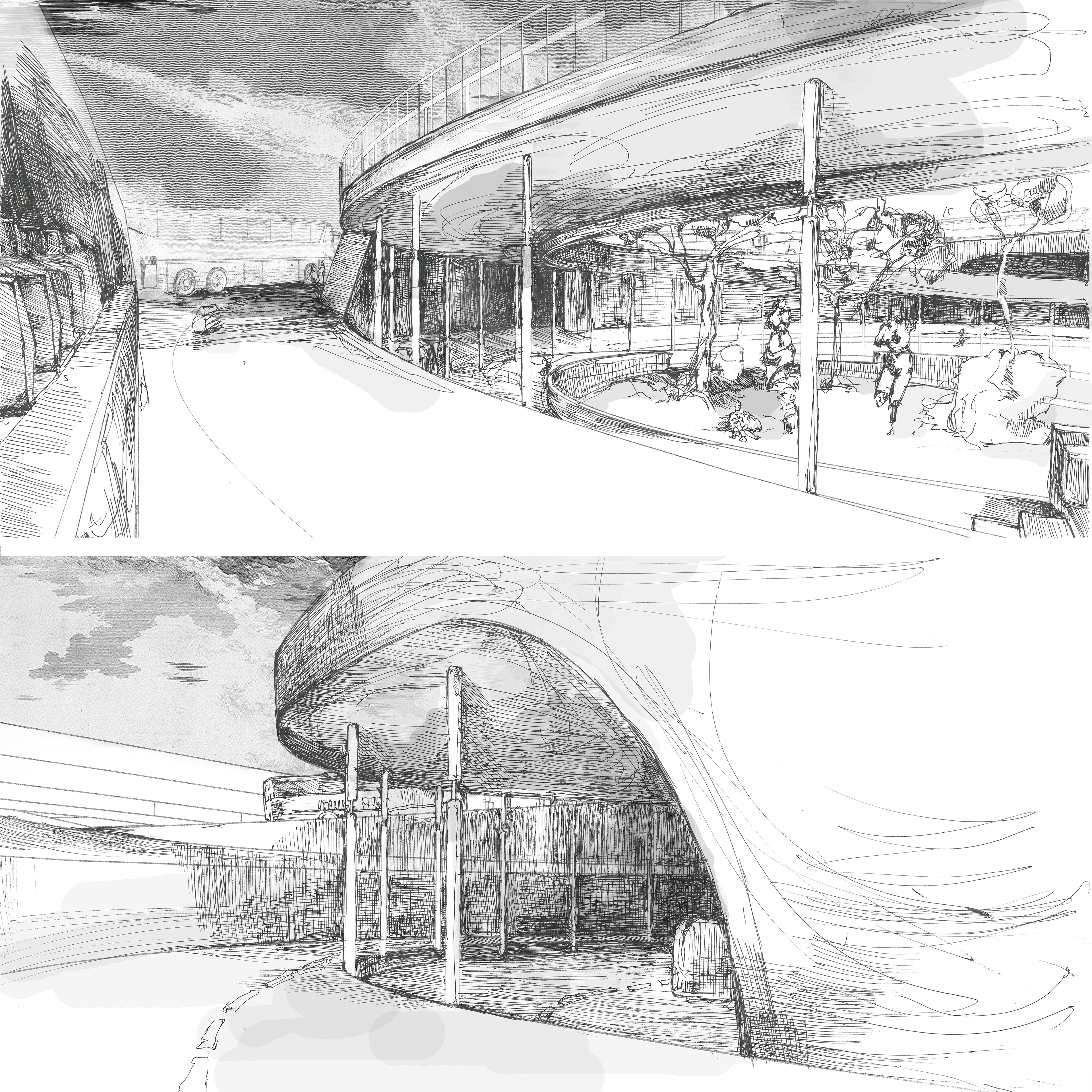
At the precise location of 41°54’32.9”N 12°31’43.3”E I begin to wonder why in the realm of public transportation a bus occupies the lowest place. Not long ago I was sketching the Milano Centrale and noticed the awe-stricken faces of both first-timers and experienced passengers as they progressed through the grand hall. And yet, as I walk around the site - massive in scale, busy and yet strangely forsaken - I notice the displeasure on the passengers’ faces. As I proceed to walk towards the Città Del Sole building, I begin to think of Roman monumentalism; an evocation of a grand scale would not be denied to the less programmatically fit structure. However, a bus station differentiates itself from a train station as it is a part of either local, or highway road system, unlike a train station that encompasses a segment of a segregated railroad. A new condition is introduced: the bus station is to be organized as a path that naturally unfolds before a bus, where the absence of uncomfortable angles and sharp turning radii will enable it to be truly a part of its context. Lying between highways, overpasses, and local roads, this bus station aims to inscribe itself into a three-dimensional framework while maximizing its capacity for passenger pickup and drop-off, as well as short-term parking.
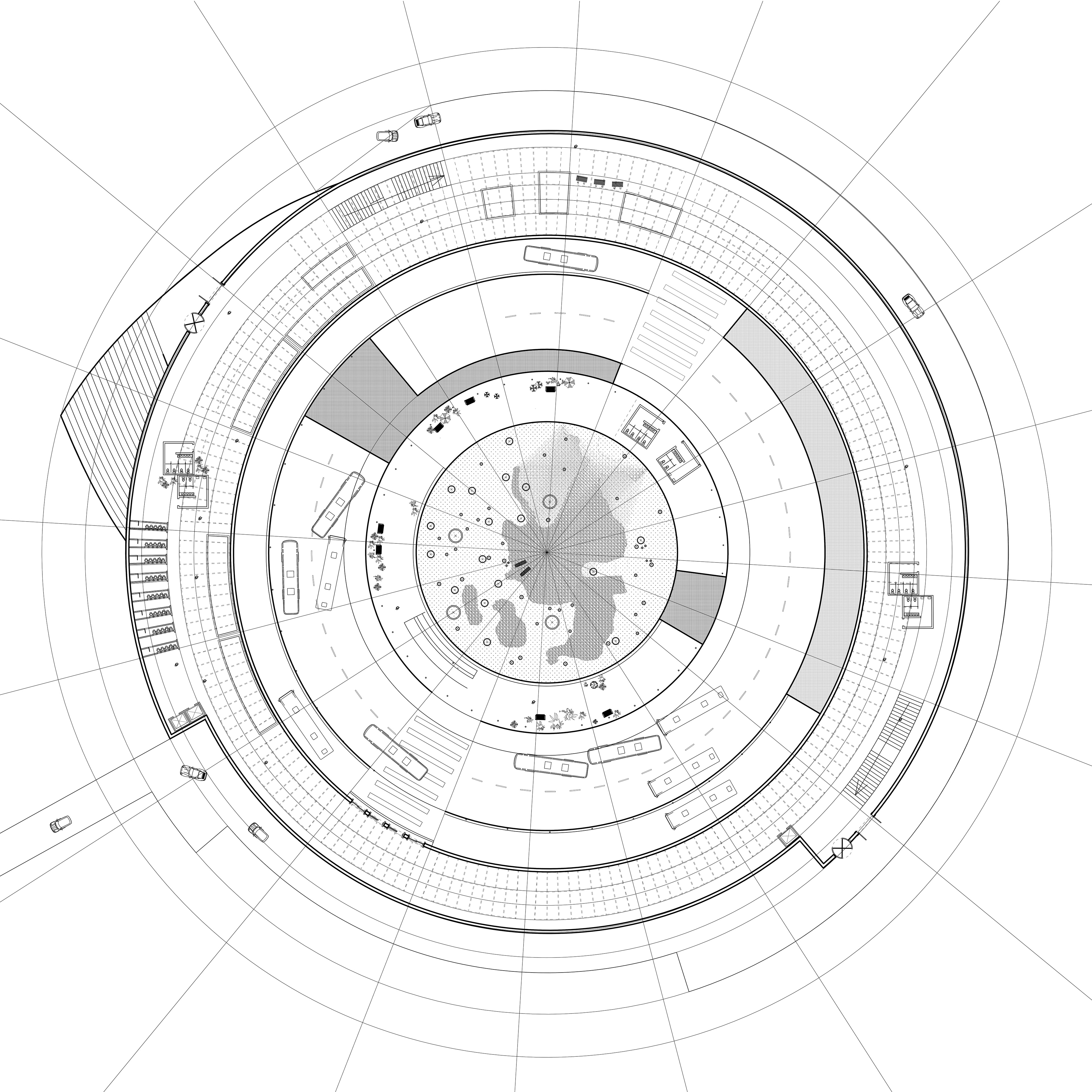
PLAN CUT AT 7 METERS BELOW GROUND LEVEL
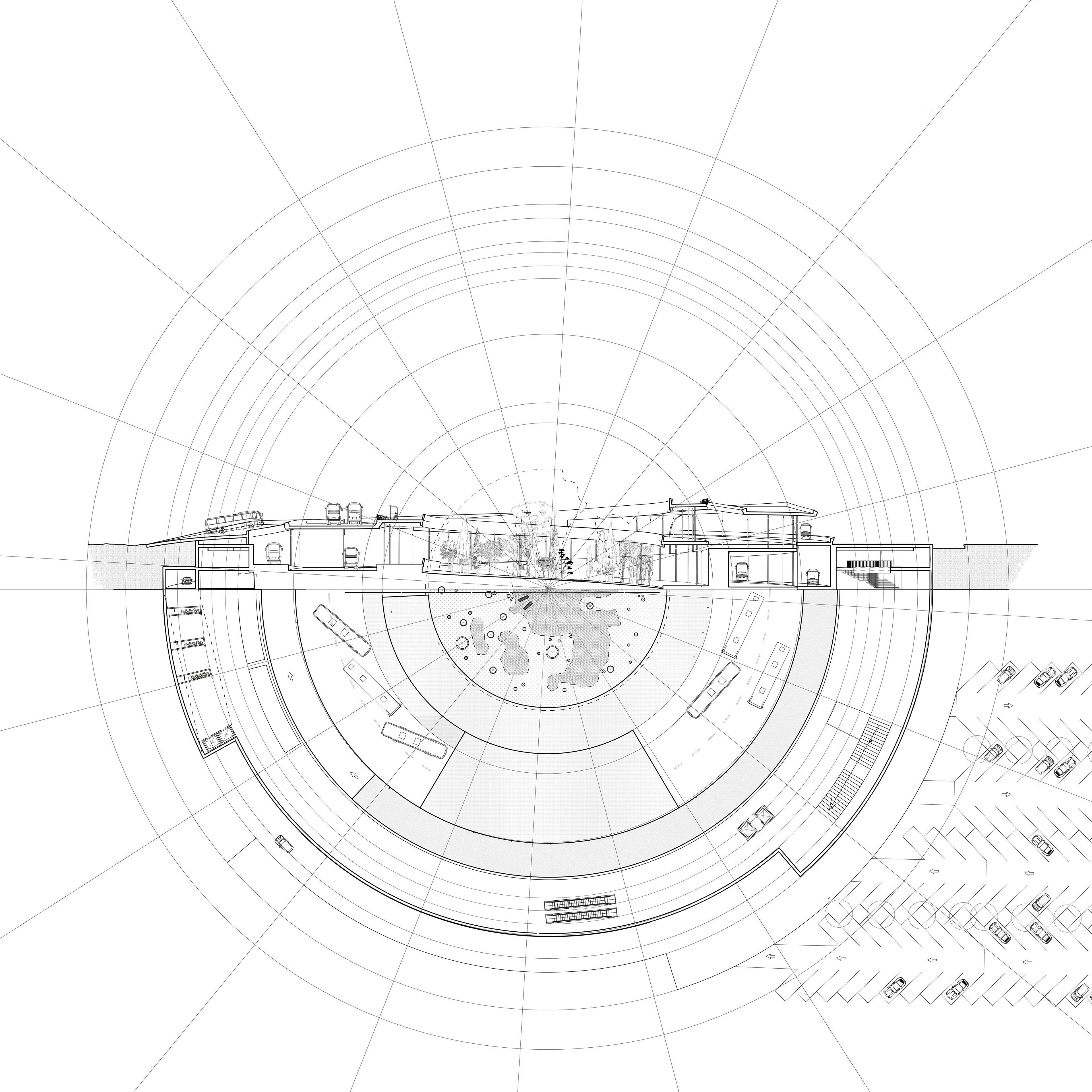
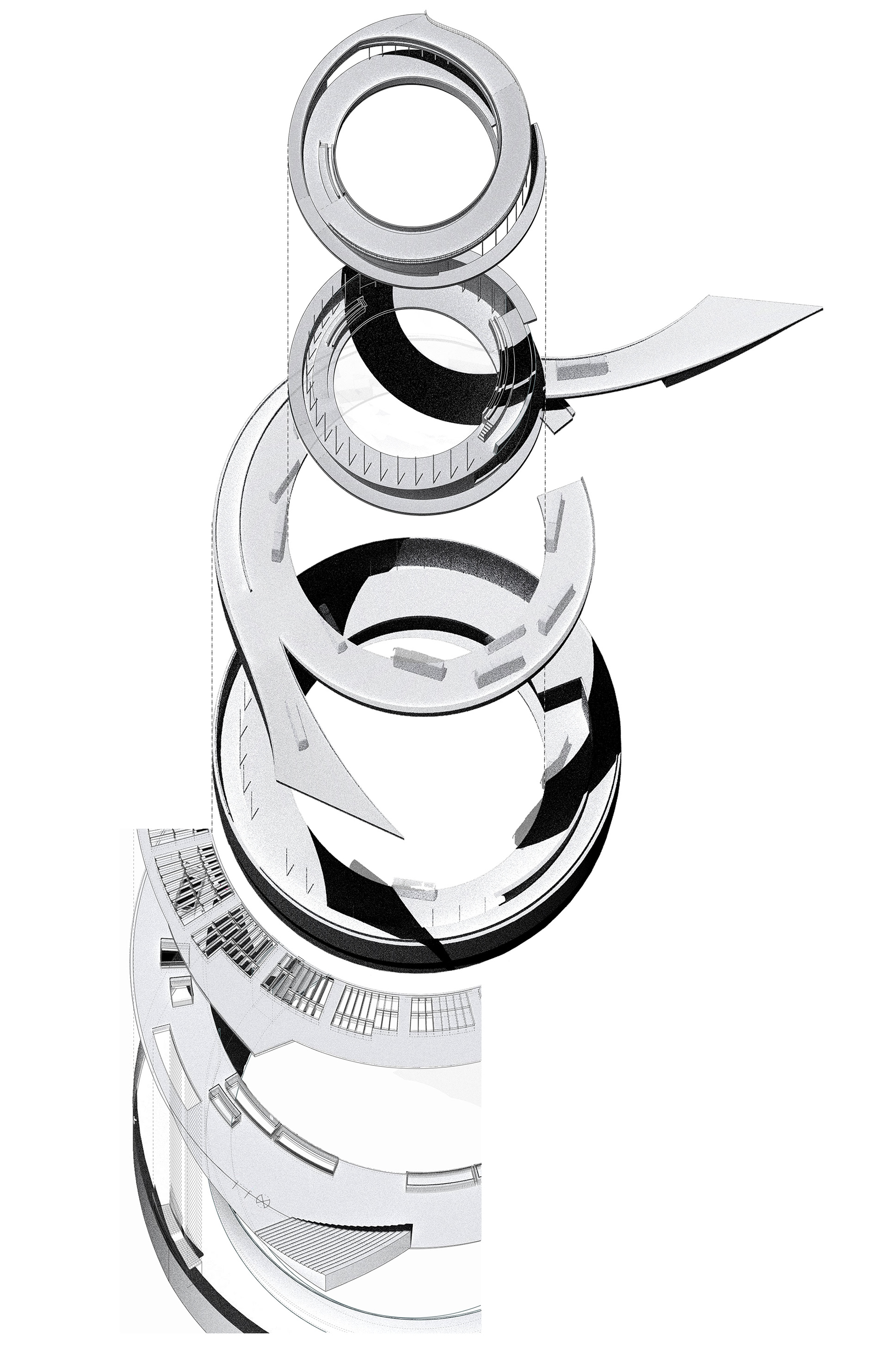
SECTION CUT THROUGH THE CENTER OF THE STATION
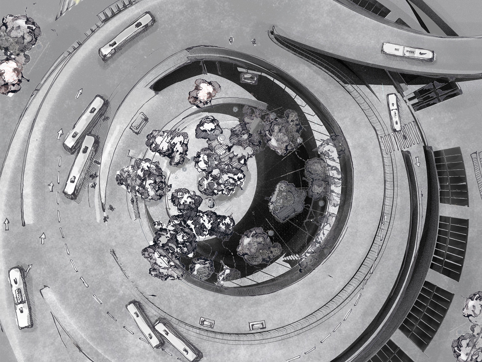
PLAN AS SEEN FROM ABOVE
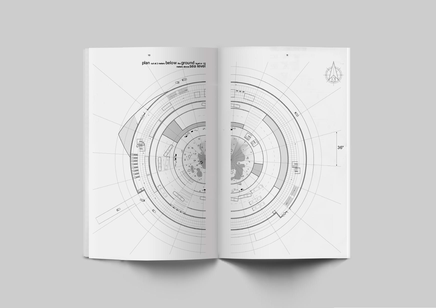
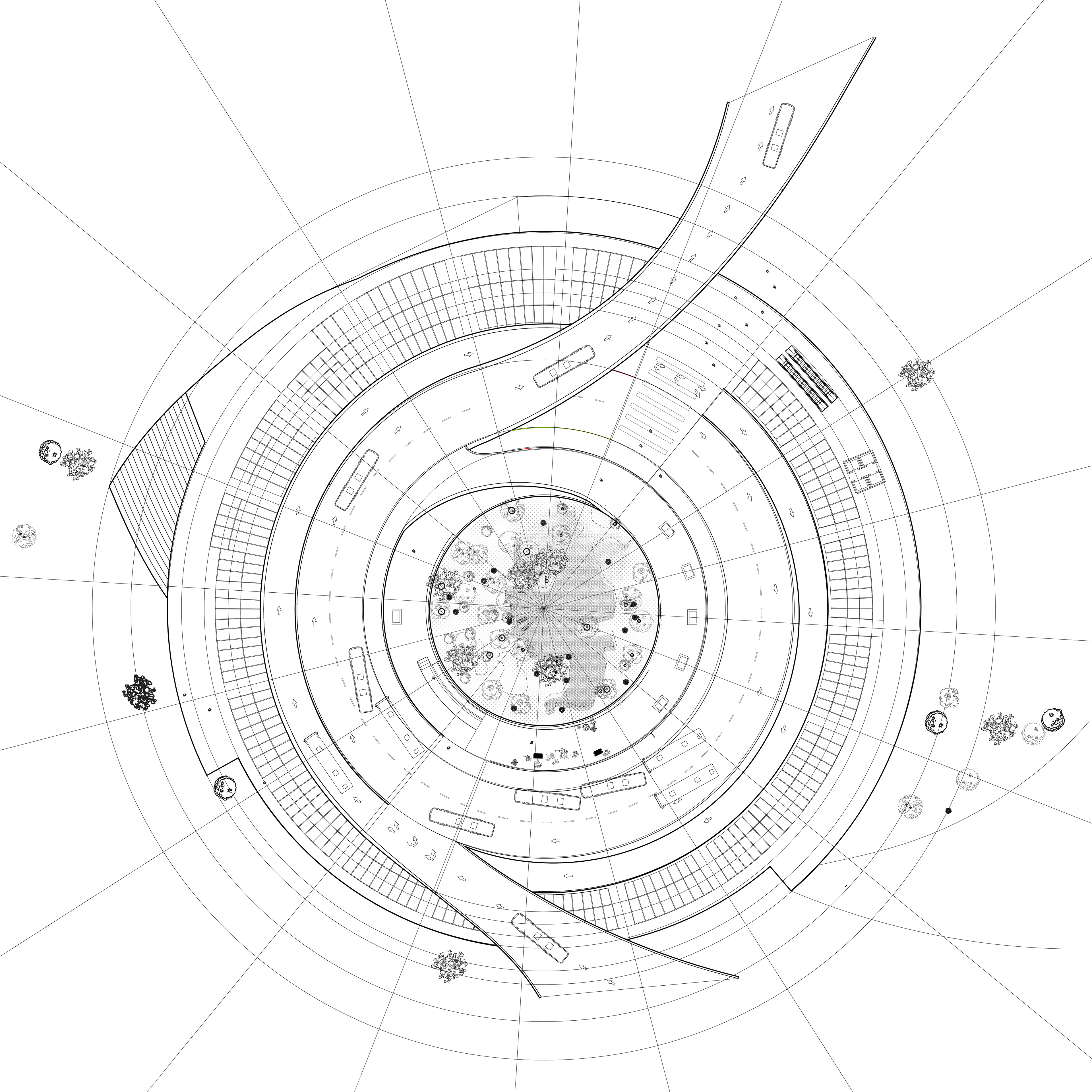
PLAN CUT AT 3.5 METERS BELOW GROUND LEVEL